Marine Resource Management: Study of fish populations and their habitats for sustainable fishing.
Marine Conservation: Research on the impact of pollution and support for marine protected areas.
Archaeology: Research, location, and conservation of underwater cultural heritage, using techniques and tools to identify anomalies or structures that could indicate the presence of artifacts.
Maritime Works: Hydrographic study is essential for the design, construction, and safe and sustainable management of maritime works and coastal infrastructure. It provides crucial environmental information that determines how the structure will interact with the sea over its lifetime.
Hydrographic activities.
The activities are carried out by research institutes, universities, government agencies, international organizations, and maritime and submarine service companies.
Scientific research is the core, divided into disciplines:
Physics: Study of the physical properties of seawater, currents, waves, tides, and the interaction between the sea and the atmosphere.
Chemistry: Analysis of the chemical composition of seawater, including dissolved gases, nutrients, and pollutants.
Marine Biology: Study of organisms, their interactions with the environment, and the biological productivity of the sea.
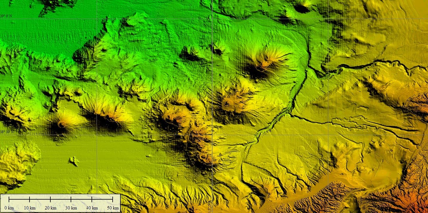
Marine Geology: Investigation of the formation and composition of the seabed and coastlines, study of marine sediments, tectonics, and volcanoes.
Data collection
Sea Surveys and Sampling: to take samples of water, sediment, and organisms, as well as to directly measure physical and chemical properties.
Fixed and Mobile Monitoring Systems: Installation of underwater buoys and gliders that continuously collect data on marine weather conditions.
Diving support: floating operations base for professional diving projects.
The design of any maritime project requires a thorough understanding of both extreme and ordinary marine conditions. Hydrography is not only used for construction, but also to manage environmental impacts.
- Coastal Erosion Control
- Environmental Impact Assessment
- Marine Renewable Energy
Research applied to maritime and coastal engineering is the scientific basis for transforming a dynamic and hostile environment into a safe and functional place for human infrastructure.
Research Institutes
SOPMARE Institute of the Regional Department of Cultural Heritage and Sicilian Identity, provides for the protection, enhancement, promotion and census of the submerged Cultural Heritage of the territorial coastal waters of the Sicilian Region. with one main purpose: to share historical scientific knowledge.

INGV National Institute of Geophysics and Volcanology, a public research body responsible for organizing seismic and volcanic surveillance through the installation and management of technologically advanced monitoring networks, in order to monitor the entire national territory and the Mediterranean basin.

IGAG is part of the Department of Earth System Sciences and Environmental Technologies of the National Research Council. The Institute’s mission is to study and understand geological and natural processes and human activities that interact with the environment.
Project MaGIC: Marine Geohazards (along the) Italian Coasts
Bathymetry with Multibeam sonar of the southern Tyrrhenian Sea