Aeolian Islands Project

exploration, knowledge, valorization 

environmental and archaeological resources

Action

Provide vessel support for  activities in the  study and achievement of marine protected areas and underwater archaeological parks in the Aeolian Islands

Archaeology Exploration of the underwater heritage to contribute to the enrichment of the archives and archaeological finds in the museums of the archipelago.

Geology/Volcanology Support  scientific research for geological activities involving a large part of the Aeolian Sea.

Biology Mapping of the biodiversity of marine flora and fauna. Studies of marine species of both economic and environmental interest.

Oceanography Data collection and analysis: winds, waves, currents.

Cartography

The Aeolian form an archipelago composed of seven main islands and several islets, rocks and shoals, positioned in the southern Tyrrhenian Sea between Calabria and Sicily, it constitutes a volcanic system determined by the subduction of the oceanic lithosphere under the continental plate, this causes the melting and release of magma that once on the surface forms the chain of islands that extends for over 200 km. In 2000 the Aeolian Islands were awarded the title of World Heritage by UNESCO, as a biosphere reserve as well as a cultural heritage.

Piri Reis map

Peoples

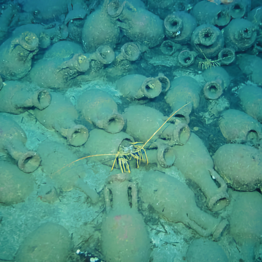
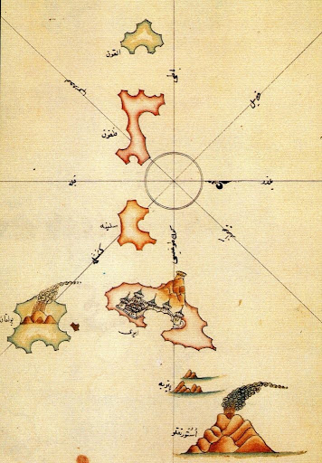
The Aeolian Islands have been a crossroads of cultures and civilizations since ancient times, inhabited by peoples in search of new lands to live in based on the needs of the time: favorable climate conditions, possibility of food supply, essential resources for social evolution (obsidian, minerals and metals).

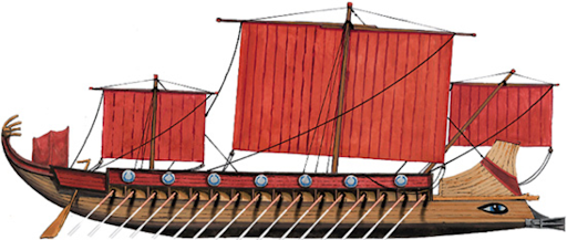
Moving by sea was much faster than by land, hence the need to design and build boats capable of navigating the Mediterranean Sea, on whose shores the greatest civilizations of the time were born. Minoans, Egyptians, Mycenaeans, Phoenicians, Romans, all with the same need: to navigate to trade, fight and exchange culture.

Objectives

  • Support  for marine activity oriented to the knowledge and protection of the Aeolian environmental and cultural heritage.
  • Acquire data and document exploration and research activities for the drafting of maps, publications and documentaries.
  • Disseminate the experiences acquired.
  • Cooperate with scientific research institutes operating in the marine field.

Flag: UK
Port: London
Official Number: 310107
Net Tonnage: 16.68
Class: Survey Vessel cat.3
Operation: < 20 nautical miles from shore
Call sign: MSU14
MMSI: 232063691

Share knowledge is essential to inform society and support environmental policies.

Dissemination

Media and Scientific Journalism: Publication of articles, features, documentaries, and social media content to report on expeditions, discoveries, and their implications for the climate, the blue economy, and the marine environment.

Exhibitions and Museums: Oceanographic museums and temporary exhibitions use artifacts, interactive models, and multimedia to educate the public, especially students.

Education and Training: Development of educational programs for schools and universities.

Citizen Science: Active Public Engagement

Institutional Initiatives: Research institutions  and international organizations actively promote targeted communication campaigns.

Kaskazi Four Play sarl 
Grundwiesstrasse n°32, 8700 Kusnacht (ZH) Swiss
kaskazifour@gmail.com 
kaskazifour.com

Attiva Stromboli APS
Via Marina snc  98050 Stromboli (ME) Italy
info@attivastromboli.net  attivastromboli.net